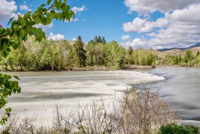
Water levels in the lower Payette River will fluctuate in the coming weeks but should remain well above recreational floating stages for another couple of months. Early April rainfall and snowfall in the higher elevations have brought snow pack and irrigation supply outlooks for the Payette drainage up to near 100 percent median levels.
Water levels in the lower Payette River will fluctuate in the coming weeks but should remain well above recreational floating stages for another couple of months. Early April rainfall and snowfall in the higher elevations have brought snow pack and irrigation supply outlooks for the Payette drainage up to near 100 percent median levels.
Wintry weather and falling temperatures broke records in Boise the first week of April.
Boise’s high of 39 degrees on April 5 was the coldest April high since 1936, said Troy Lindquist, a hydrologist with the National Weather Service, on Friday at a monthly water supply meeting to discuss weather and water conditions in the state.
April 4 brought over an inch of rain to Boise, with April 5 bringing just over another inch. That is only the second time ever that Boise has received more than an inch of rain on consecutive days, Lindquist said.
And if you’ve noticed your lawn looking a little greener than usual this time of year, that may be in part because Boise has had the wettest start to the year on record, and has already exceeded its typical precipitation for the water year — about 12 inches; Boise has received 12.77 inches so far — which runs from October through September.
But this weekend, Boise area temperatures will be well-above normal, approaching 80 degrees on Friday and reaching 80 on Saturday, Lindquist said.
Temperatures are predicted to dip back below normal on Tuesday and Wednesday, accompanied by light precipitation, followed by rising temperatures Thursday and Friday.
The southern part of the state remains in good shape from a drought perspective, while parts of the central and northern part of the state remain in drought.
Do you LOVE local news? Get Local News Headlines in your inbox daily.
Thanks! You'll start receiving
the headlines tomorrow!
SNOW MELT BEGINS IN EARNESTMost of the state climbed out of a record-low snowpack on Jan. 1, said David Hoekema, a hydrologist with the Idaho Department of Water Resources. Now, with generally normal snowpack across the state, most rivers are looking at normal or near-normal streamflow going into the summer.
The mountains that feed the Owyhee River and its reservoirs have received quite a bit of snow. Unlike last year, which brought rapid melt off, this year’s snow is “polite melt off,” as in melting off in “fits and starts,” said Erin Whorton, a hydrologist with the Natural Resources Conservation Service.
There has been some localized flooding below Owyhee Reservoir, but so far it is minimal and not as much as initially predicted, said Ryan Hedrick, a water operations lead with the Bureau of Reclamation.
On the Boise River, water managers are planning to increase flows from Lucky Peak Dam to 4,000 cubic feet per second next week, up from 3,000 cubic feet per second. Flood stage on the Boise River is generally considered to be above 7,000 cubic feet per second.
LA NIÑA ON THE HORIZON
While El Niño conditions are still present in the Pacific Ocean, those are expected to shift in the coming months toward La Niña conditions, which typically bring colder, wetter weather the northwest, including Idaho, Lindquist said.
“So we’ll see how that pans out, but wouldn’t it be great?” Lindquist asked.
Erin Banks Rusby covers Caldwell and Canyon County. She reports on local government, agriculture, the environment, and more. She can be reached at erusby@idahopress.com